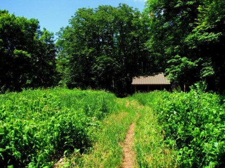
Took the time for an early morning jaunt out of Tremont up Panther Creek and down Lynn Camp Prong before returning to work. 
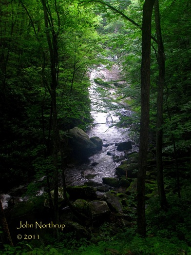
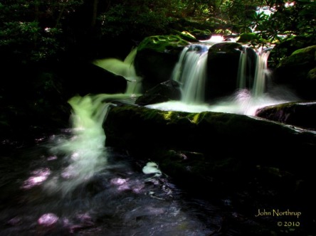
One of the more beautiful and serene settings in the park, the Middle Prong Trail circles hikers right around the Lower Lynn Camp Prong Cascades. 
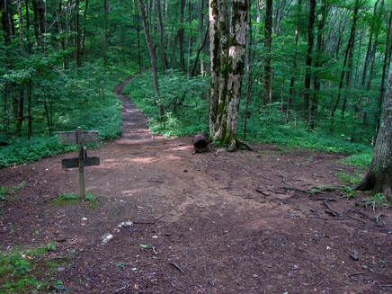
After a good deal of ascending, I was grateful to arrive at Jakes Gap. 
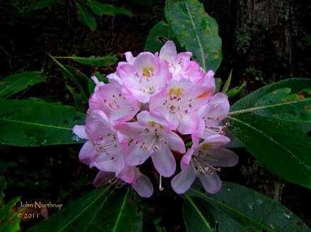
The Rosebay Rhododendron at the mid to upper elevations were adding beauty to the landscape much of the day. 
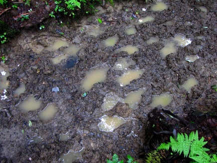
The trip down Lynn Camp Prong was dotted with mud pits that required some fancy footwork on my part. 
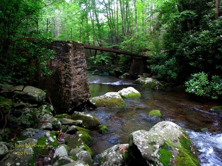
Looking back at the rickity old steel beam bridge over Thunderhead Prong.
0 Comments
With all my talk about choosing the best hikes around the flame azalea and catawba rhododendron blooming schedule, one would probably wonder how I chose to do this hike. Well, I had two of the big three done, saving Andrews Bald for later. Plus I had two other days off to plan something, so I figured I would give the climb out of Tremont up to the AT a go. It was a change of pace from the upper elevation hikes because this started low and afforded numerous waterfalls, cascades, and streamside walking. I was looking forward to it because hardly any of the hikes I had done this year were centered on such features, but rather vistas and wildflowers. The last time I visited the Middle Prong Trail out of Tremont was last fall with my uncle. We had seen some impressive colors, and the fact that we did the first stretch in the rain saw the numerous cascades of Lynn Camp Prong as loud, raging, and overflowing with water. Since the park hadn't seen much rain as of late, I figured the water scenes would be more subdued this time around. The first several miles of the trail are easy and enjoyable. It follows an old railroad grade next to the river and barely ascends. Early on you come around a long bend that overlooks the lower portion of the Lynn Camp Cascade. This lower section is much flatter and longer than the other parts of the cascade series. A little further up the trail you pass the upper part of the cascade in which the various falls are shorter and terraced. As I predicted, there was less water coming across the rocks, but a very pleasant scene to behold regardless. The cascades now behind me, I was able to focus more on the surrounding wildflowers, greatly dominated by the purple heal-all. I was amazed at how well it flourished, not only beside the trail, but even in it. It was everywhere for miles. At one point I came to a clearing that was the location of a former CCC camp, and it too was overrun with heal-all. Some old rusty parts could be found scattered across the old camp including an entire piece of train track. Towards the end of the Middle Prong Trail, the trail widens as it makes a sharp switchback heading uphill. If you look off to the right, you'll see a narrow but well trodden path heading into the woods. If you follow it for about a tenth of a mile, you'll descend into Indian Flats Falls. It's an enclosed swimming hole with several individual waterfalls pouring in and out from all around. If you're ever looking for a place to cool down and relax in solitude, I would recommend going here for sure. After returning back to the main trail and approaching the junction with Greenbrier Ridge I came across a doe. She kept trotting uphill in a zigzag pattern as I got closer, but never left the actual trail. When I came to another switchback she eventually stepped to the side and watched me pass but never seemed quite sure what to make of me. Now following the Greenbrier Ridge Trail up to the AT, the trail conditions changed dramatically. It was now you're typical narrow path, sometimes overgrown in places, and a much steeper climb than that of the old railroad bed. I already come halfway, but in terms of elevation gain, you wouldn't think so. Wildflowers at this point included rosebay rhododendron, more heal-all, some red bee balm, and even blooming ramps. About halfway up the Greenbrier Ridge section, the most interesting part of my day happened. I stumbled across an eight point buck on the trail that was startled by my arrival. But it didn't run off into the woods because the hillside was too steep and overgrown for it make an escape, so it had to remain on the trail. It would gallop ahead of me for a ways...stop...look back...wait for me to catch up...then repeat the cycle. This must have gone on for a half mile or more. I could never get to a point where both of us were stopped to get a good picture. Since we were going uphill, each time he stopped to look back he had his tongue drooping way out like a panting dog. Another interesting feature about this buck had to do with his antlers. They were atypical in which they didn't curve upwards and above the head like you usually see, but extended straight out like that of longhorn cattle. Eventually we rounded a ridgetop where he could step off the trail and find cover in the brush, which was also where we were closest, only a few yards apart separated by a rhododendron. We parted ways and I thanked him for the excitement. When I reached the AT, I had a decision to make. I could stop right there and have my lunch in the cool breeze and wooded ridgetop, or I could push on a few more tenths of a mile to the Derrick Knob Shelter. It would entail the steepest climb of the day, but I figured that since I was in one of the more remote areas in the park, plus not knowing when I would return, that I better suck it up and pay the shelter a visit. The first and last time I was there was eight years ago on a backpacking trip with my father and uncle in which we stayed at the shelter before it was renovated. Coming into the clearing and seeing it all redone was neat and sitting inside while enjoying my lunch was nostalgic. A couple that had stayed there the night before was about to leave on a day hike and warned me of timber rattlesnake down by the spring. As much as I would have loved to get a picture, I thought it smarter to pass on it. I wrote a little something in the log book at the shelter, finished reminiscing, and headed back down the mountain. Since I was doubling back, the miles became menotonous, especially since there were no views, few wildflowers, and no more deer to chase, but still an incredible day of hiking with all things considered. It ended up being my longest hike of they year thus far, coming in at 17.4 miles. Come August I have several longer hikes planned, but none of them will entail the elevation change that I encountered today heading up from Tremont to Derrick Knob.
|
Thanks for visiting!I appreciate you stopping by. This site is for your enjoyment as much as it is mine. Look for new photos and journal entries about every 1-2 weeks. Archives
November 2011
Categories
All
|